
【Disaster prevention】Sri Lanka|AW3D Standard
Evaluation of “the whole aspect of the landslide disaster damage and secondary damage risk” by grasping landslide topography utilizing AW3D
Japan International Corporation Agency(JICA)
The landslide disaster occurred on Oct. 29th 2014, which was the largest scale ever recorded. JICA conducted the disaster initial survey. Conduct comprehensive damage and secondary risk assessment for the region including the surrounding areas.
Determined the pre-disaster topography using AW3D Compared this with post-disaster topography taken from a helicopter and evaluated the entirety of disaster damage and the risk of the secondary damage.
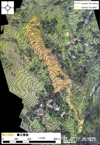
Topography comparison between pre / post- disaster
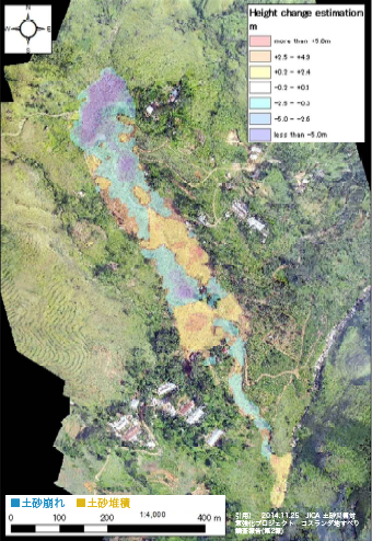
The whole aspect of the disaster
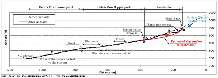 Assumed cross section of Koslanda Landslide
Cooperation/Reference/Data source
Survey Results of Koslanda Landslide (2nd Report), JICA Technical Cooperation for Landslide Mitigation Project, November 25, 2014