2017.07.28
AW3D Enhanced achieved 30cm accuracy on Accuracy Assessment over San Francisco area.
Accuracy Assessment Report of 0.5m Resolution AW3D Enhanced DSM
We conducted an accuracy assessment of the elevation value of 0.5m resolution AW3D Enhanced Digital Surface Model (DSM) over San Francisco area. The assessment is based on point clouds dataset collected with LiDAR by Federal Emergency Management Agency (FEMA) of the United States.
The target area was 4.5km long and 2.3km wide, and we compared AW3D data against about 550,000 values of point clouds data over this area. There are about 3,600 buildings and some open spaces in this target.
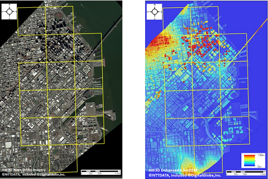
left image: Target Area
Right image: AW3D Enhanced DSM (0.5m res)
This accuracy assessment was conducted by comparing between the elevation values of AW3D Enhanced DSM and the Z values of LiDAR data.
Histogram of elevation difference is shown in Fig 3. As shown in Fig 3, most differences were fit within±0.5m range, which statistically calculated as 0.28m RMSE, and 0.42m LE90 accuracy. Distribution of elevation differences shown in Fig 4 and 5 also indicate that the differences were not concentrated on particular types of building or area.
We will continue to perform similar accuracy assessments in other areas.
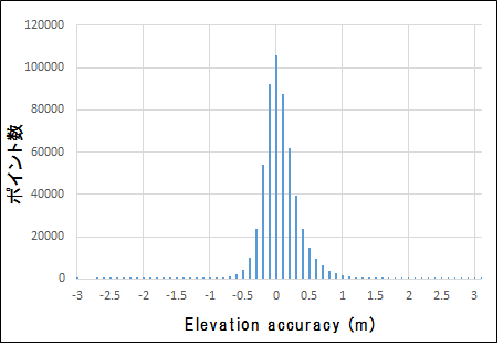
Histogram of Elevation Differences between AW3D and LiDAR data
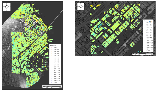
Left:Distribution of elevation difference
Right:Distribution of elevation difference (zoomed)