Nationwide US/UK/Japan 3D Base map
Off-the-shelf data solution
All data of the Nationwide 3D Base Maps have been processed, verified, void-infilled, and error-corrected to support unmatched short lead time. They are provided in industrial-standard formats so that you can directly adapt them to virtually any professional solution.
3D vectors (building/vegetation/bridge)
Land use / land cover (DLU)
3D vectors (building)
-
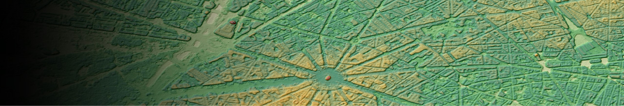
Seamless, uniform, and consistent
Nationwide 3D Base Map has been proven practical and cost-effective through many successful projects thanks to its homogeneity. Our best-in-class manufacturing process chain ensures that you will enjoy reliable high-quality data of a given target area without unwanted gaps and seams.
-
Wide range of data types
From Nationwide 3D Base Map data set, you can leverage diverse data types that are not available from existing nationwide open/free data, such as SRTM (Shuttle Radar Topography Mission) 30m DSM, 1/3rd arc-second DEMs (3DEP / NED 10) by USGS, or 5m / 10m DEM(DTM) by GSI: Geospatial Information Authority of Japan.
Included Data Layers *1:
- Digital Elevation Models (DEM: DSM/DTM)
- 3D Vectors (building/vegetation/bridge)
- Land use / land cover – DLU (Clutter)
- Clutter height (DHM: Digital Height Model)
Target users:
- Mobile network operators and network equipment vendors
- Federal/Central Government
- Local Government (law enforcement, first responders)
- Utility companies (water/gas/electricity)
- Railroad operators
- Smart city planners
Applications:
- RF simulation and wireless network design & planning
- Long distance wireless communication design
- Large scale disaster mitigation and management
- Smart city planning, including wide area green space optimization
- Environmental Simulations
- Flight simulator
- Line-of-site analysis
*1: varies depends on the area and other factors
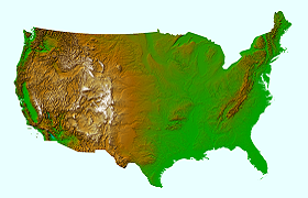
United States
High resolution: more than 60 cities, Middle resolution: CONUS (contiguous United States)
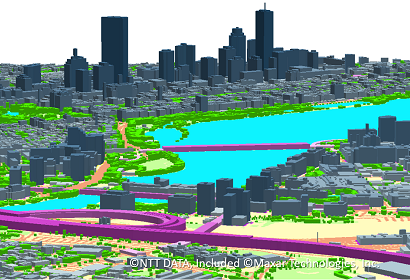
High resolution 3D map for urban areas
| Product layer | 3D Vector, DHM / DLU / DTM (1m) |
|---|---|
| Coverage | More than 60 cities in US |
| 3D vector layers | Building / vegetation / bridge |
| DLU classes | 25 classes |
| Horizontal accuracy | 2m RMSE |
| Vertical accuracy | 1m - 2m RMSE |
| Vintage | 2019 - 2020 |
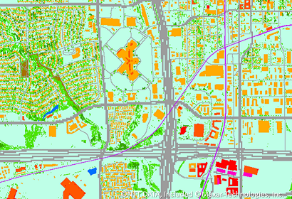
Middle resolution 3D map for all over CONUS (Contiguous United States)
| Product layer | DHM / DLU / DTM (10m) |
|---|---|
| Coverage | CONUS: Contiguous United States |
| DLU classes | 25 classes |
| Horizontal accuracy | 10m RMSE |
| Vertical accuracy | Approximately 10m RMSE (consistent with DLU) |
| Vintage | Mainly 2020 |
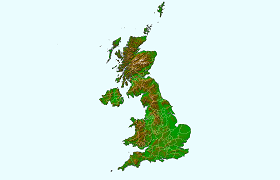
United Kingdom
High resolution : about 300 cities/towns that have more than 30,000 population
Middle resolution : The whole of the Great Britain and Northern Ireland
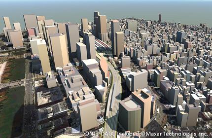
High resolution 3D map for urban areas
| Product layer | 3D Vector, DHM / DLU / DTM (2m) |
|---|---|
| Coverage | Greater London and other 300 cities/towns in UK. |
| 3D vector layers | Building / vegetation / bridge |
| DLU classes | 25 classes |
| Horizontal accuracy | 2m RMSE |
| Vertical accuracy | 1m - 2m RMSE |
| Vintage | Greater London: 2021 - 2022, Others: Mainly 2018 - 2022 |
Middle resolution 3D map for whole of the Great Britain and Northern Ireland
| Product layer | DHM / DLU / DTM (10m) |
|---|---|
| Coverage | The whole of the Great Britain and Northern Ireland |
| DLU classes | 26 classes |
| Horizontal accuracy | 10m RMSE |
| Vertical accuracy | 10m RMSE |
| Vintage | Mainly 2018 |
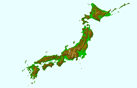
Japan
1:2,500 map scale nationwide DSM (0.5m), DTM (5m), 3D building, Ortho (30cm), and value added package product for telecom.
AW3D Enhanced DSM (0.5m), DTM (5m)
| Product layer | AW3D Enhanced DSM (0.5m), DTM (5m) |
|---|---|
| Coverage | Entire Japan |
| Horizontal accuracy | 1.75m RMSE |
| Vertical accuracy | 1m RMSE |
| Vintage | Bi-annual update (plan) |
AW3D Building
| Product layer | 3D Vector |
|---|---|
| Coverage | 90% population coverage (approx. 100,000km2) |
| Horizontal accuracy | 1.75m RMSE |
| Vertical accuracy | 2m RMSE |
| Vintage | Bi-annual update (plan) |
AW3D Ortho (30cm)
| Product layer | AW3D Ortho (30cm) |
|---|---|
| Coverage | Entire Japan |
| Horizontal accuracy | 1.75m RMSE |
| Vertical accuracy | (N/A) |
| Vintage | Bi-annual update (plan) |
Valued added package product for telecom
| 3D vector (building / vegetation / bridge) | DHM/DLU/DTM (5m) | DLU/DTM (20m) | |
| Coverage | Capital cities | Capital cities | Other area |
| Horizontal accuracy | 5m RMSE | 5m RMSE | 20m RMSE |
| Vertical accuracy | 1-2m RMSE | 5m RMSE | 10m RMSE |
| Vintage | 2020 | 2020 | 2019 - 2020 |
Details
| Product Type | Vector data, Raster data |
|---|---|
| Satellite | JAXA - ALOS, Vantor (former Maxar Technologies) - WorldView, and other satellites |