Terrain and obstacles dataset optimized for aviation standards (eTOD)
We provide complete eTOD (electric Terrain & Obstacle Data) datasets created from high-resolution satellite imageries, which is required data for plane's take-off and landing procedures, as well as airport's facility management.
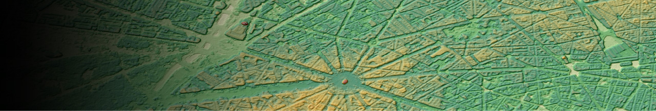
Taipei Songshan Airport(eTOD)
-
Lower cost for updating obstacle dataset of facilities around airport
By using satellite imageries in the process, lower cost in providing 3d datasets of latest terrain and obstacles becomes possible.
We also provide Airport Mapping Database (AMDB) for map inside the airport area. -
Comply With International Standard
Our datasets are fully complied with industry's major international standards such as ICAO, makes it highly usable for any aviation application such as flight route plan calculation.
Taipei Songshan Airport(eTOD)
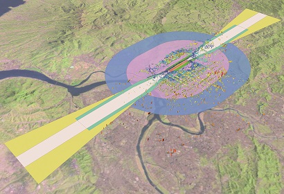
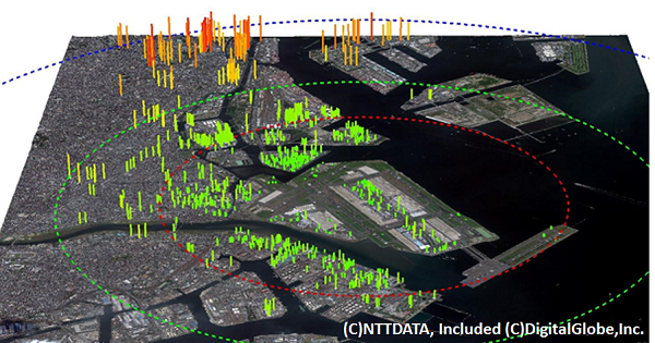
Haneda_Airport3D(eTOD)
Details
| Product Type | Vector data, Raster data |
|---|---|
| Satellite | Vantor (former Maxar Technologies) - WorldView etc |
| Horizontal Accuracy | ICAO Annex-15 criteria(eTOD) 5m CE90(Area2) |
| Vertical Accuracy | ICAO Annex-15 criteria(eTOD) 3m LE90 (Area2) |
| Minimum Order Size | 25km2 |
| Delivery Formats | Vector data: Shape format (.shp) etc Raster data: GeoTIFF etc |
| Delivery Method | Online or Media (DVD) |