CLOSE
CLOSE
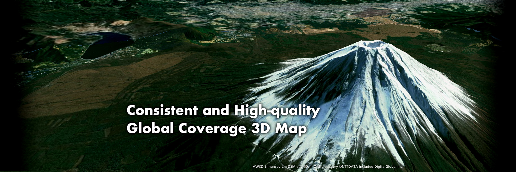


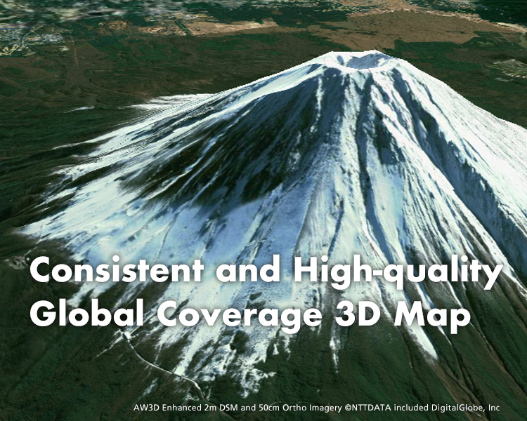


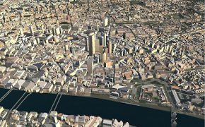
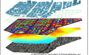
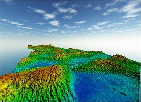
High-resolution digital 3D map covering the entire global land area
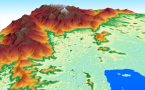
The highest precision DEM in 0.5m Resolution
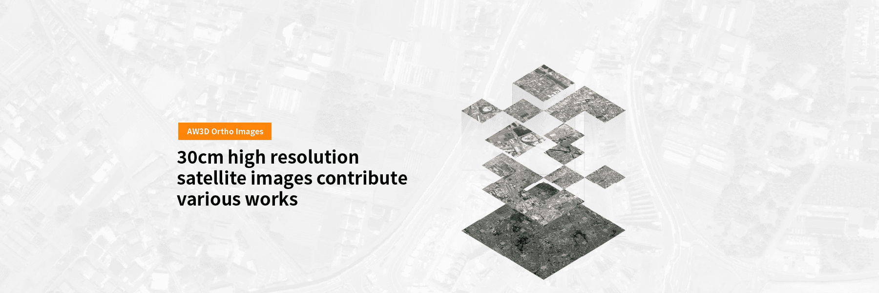
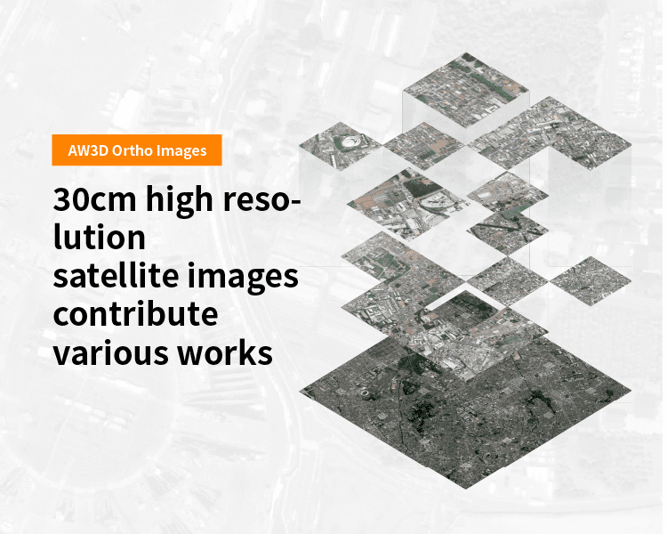
The highest quality orthorectified imagery in the world
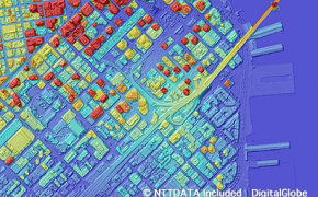
Global high-resolution Building 3D Vectors
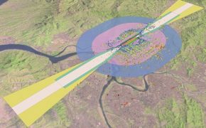
Perfect 3D datasets for any simulation of wireless signal propagation
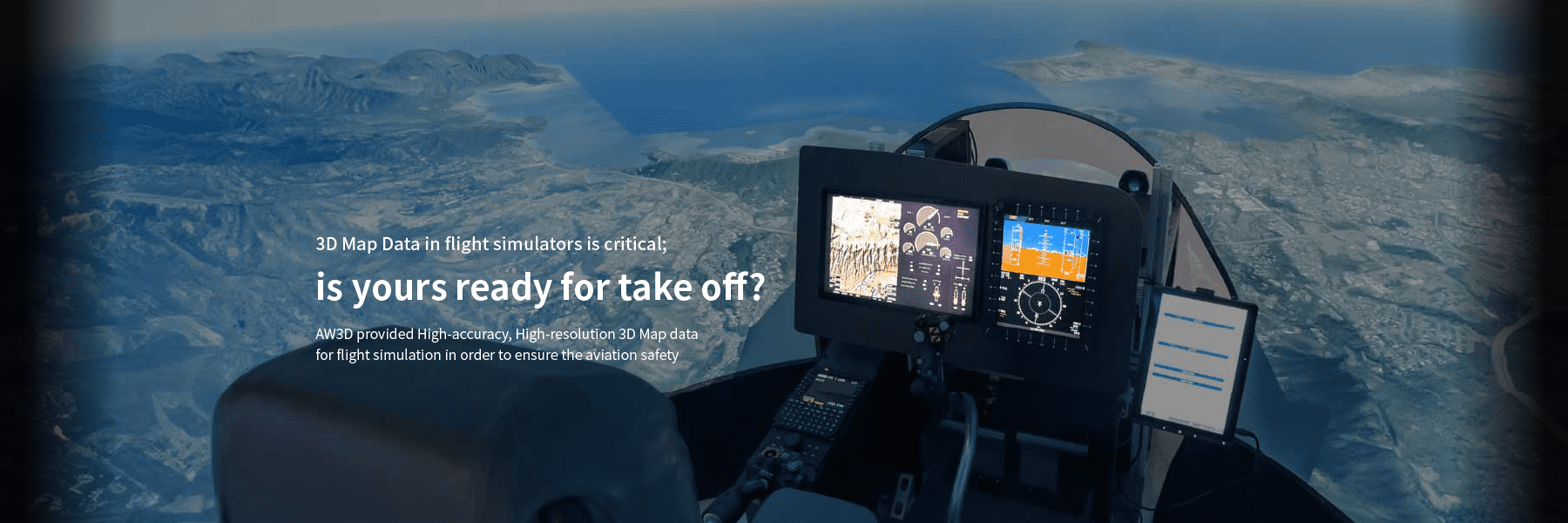
Terrain and obstacles dataset optimized for aviation standards (eTOD)
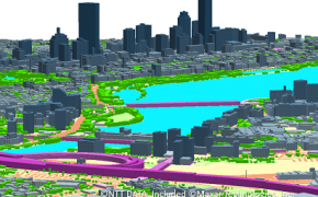
Nationwide archived 3D dataset for US, UK, and Japan
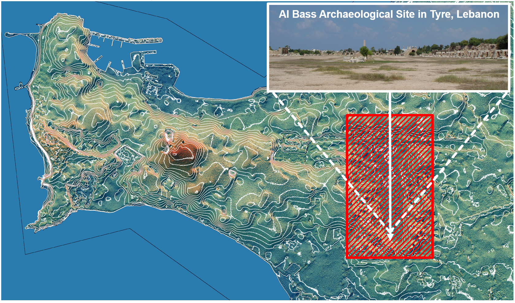
【Archaeology】Lebanon
Remote sensing plays a crucial role in modern arch...
【Agriculture】Egypt
Increasing agricultural productivity in Egypt is a...
【Mining】Worldwide
For mining companies, it is critical to understand...
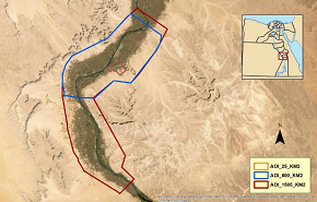
【Pipeline】The Grand Erg Desert, Algeria
JGC Algeria S.p.A (“JGC”), one of the biggest oil ...
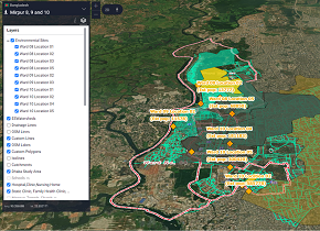
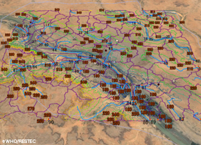
【Health】Bangladesh, Pakistan
Dr. Mami Taniuchi, an infectious disease researche...
【Disaster study】Namibia
For the research of mitigating seismic hazards, Mc...
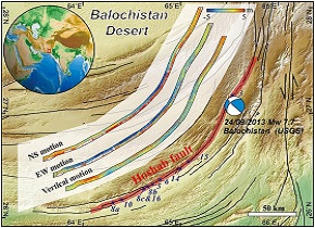
【Earthquake analysis】Pakistan
AW3D Standard Level2 DSM (1,274 sq.km) was used fo...
【Civil engineering】Mexico
Cambria Geosciences Inc. is a civil engineering co...
【Flood simulation】LATAM
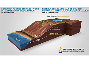
Oceanus Power & Water is an advanced company t...
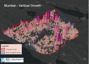
【Urban planning and assessment】India, Mozambique
Independent Evaluation Group (IEG) of the World Ba...
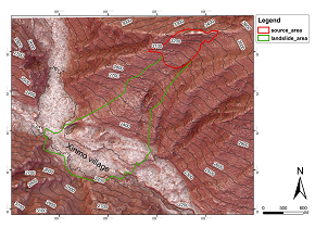
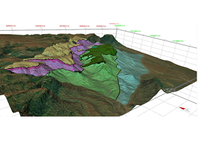
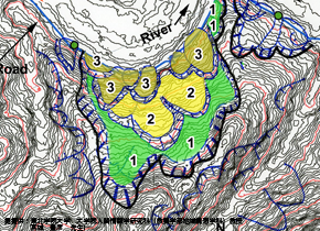
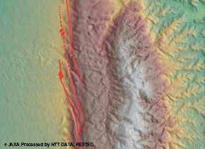
【Landslide analysis】Shichuan, China
The catastrophic large-scale landslide triggered b...
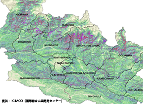
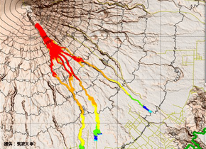
【Disaster prevention】Nepal
Nepal has many steep mountains, and measures again...
【Mining】Worldwide
Efficient mineral exploration in remote location s...
【Power Plant】Inside and outside of Japan
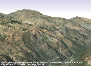
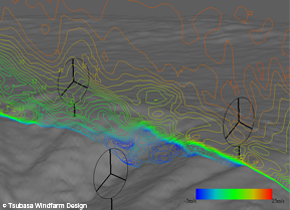
Mountainous areas in Japan have complicated topog...
【Health】Nigeria, Niger
Nigeria, Pakistan, and Afghanistan are registered ...

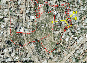
【Urban planning】Japan
When planning large-scale shops in urban areas, it...
【Disaster prevention】Vietnam
Necessity of landslide disasters prevention on the...
【Disaster prevention】Myanmar
Necessity of active faults distribution study for ...
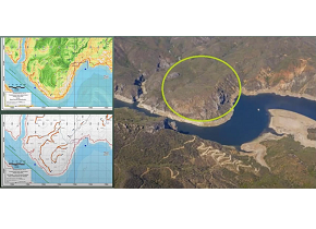
【Disaster prevention】Honduras
Tegucigalpa, the Capital of Honduras is surrounded...

【Disaster prevention】Sri Lanka
The landslide disaster occurred on Oct. 29th 2014,...
【Disaster prevention】Indonesia
Semeru Volcano eruptions have been caused serious ...