
【Archaeology】Lebanon|AW3D Enhanced
Archaeological Research of Buried Mausoleums in Conflict Areas – Al Bass site, Tyre, Lebanon
Professional College of Arts and Tourism (Japan)
Remote sensing plays a crucial role in modern archaeological research. Slope and Aspect, calculated from AW3D Enhanced DTM (0.5m), empower archaeologists to observe subtle elevation differences that are difficult to discern on-site. This detailed terrain view facilitates focused and efficient research by enabling the prioritization of critical areas of excavation.
Leveraging Cutting-Edge Technology for Efficient Discovery
At the Al Bass archaeological site, a research team from Hiroshima University and Professional College of Arts and Tourism undertook a fascinating project: excavating large mausoleums within a depression and exploring subterranean facilities. To achieve this, they turned to AW3D’s Enhanced Digital Terrain Model (DTM) data.
AW3D provided the team with a unique perspective –a detailed terrain view of the entire area. This vantage point revealed subtle variations in elevation, invisible to the naked eye on the ground, that hinted at potential archaeological sites. These minute details, crucial for archaeologists, served as valuable clues to unlock the past.
Armed with these insights, the team meticulously analyzed the target area’s surroundings. AW3D data enabled them to pinpoint key areas with remarkable accuracy, eliminating the need for an extensive and time-consuming exploration. This meticulous approach facilitated streamlined and efficient research, maximizing their valuable time and resources.
This archaeological project at the Al Bass site demonstrates the transformative impact of AW3D technology. By leveraging high-resolution terrain data, research could efficiently pinpoint key areas and conduct focused exploration, saving time and resources. Looking ahead, AW3D holds immense potential for the future of archaeology, enabling remote exploration of inaccessible sites and optimizing on-site planning for groundbreaking discoveries.
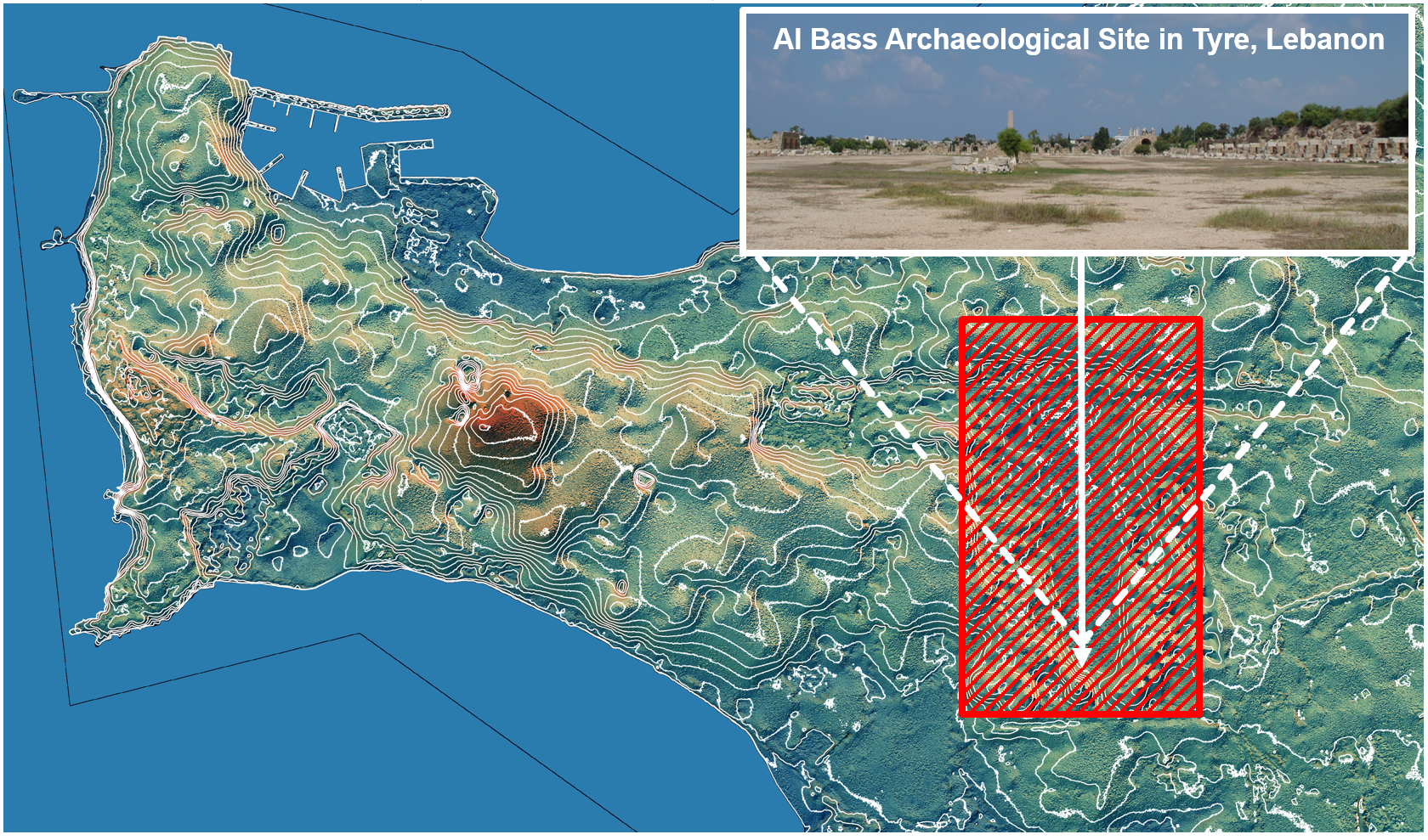
An example of a topographic map emphasizing micro-terrain features using Slope and Aspect calculated from AW3D Enhanced DTM

AW3D Enhanced DTM reveals previously unseen subtle elevation features, aiding in archaeological investigations where ground verification is challenging
Cooperation/Reference/Data source
Professional College of Arts and Tourism
Hiroshima University