
【Disaster prevention】Nepal |AW3D Standard
Hazard map for long-term reconstruction plan after the major earthquake
ICIMOD (International Centre for Integrated Mountain Development)
Nepal has many steep mountains, and measures against natural disasters related to such terrain characteristic are an important issue for its land development. After the massive earthquakes in 2015, landslide disaster was the growing risk nationwide. However, high accuracy 3D maps covering the whole nation was not available before.
By utilizing AW3D, high risk areas of landslide disaster are pointed out, make it possible to develop landslide hazard maps on the several earthquake damaged areas. The hazard maps will be utilized as a fundamental information of long-term reconstruction plan and resettlement plan in Nepal government.
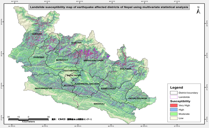 “Landslide hazard map of the major earthquake damage area in 2015“ utilizing AW3D
Cooperation/Reference/Data source
ICIMOD (International Centre for Integrated Mountain Development)