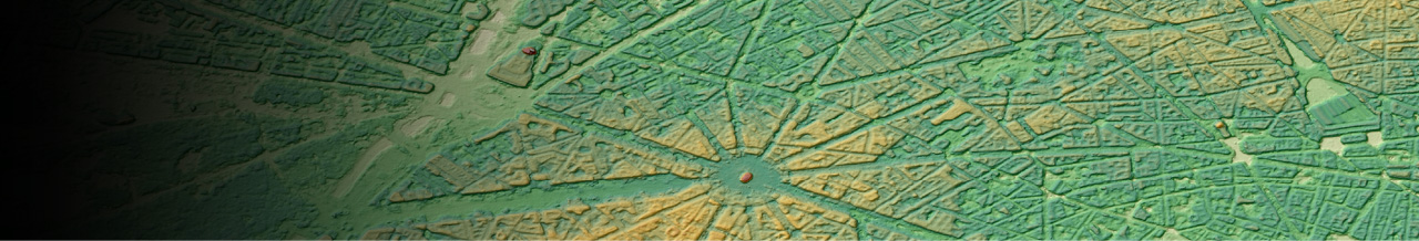
The highest precision DEM in 0.5m Resolution
High accuracy of 0.5m in both horizontal and vertical direction is realized with Vantor's (former Maxar’s) satellites. The product offers wide range line-ups of 0.5m, 1m and 2m mesh product at the same accuracy level. We combine images shot by several satellites and produce high-resolution 3D map. This provides terrain models with such high resolution that detailed variations in tree height can be determined.
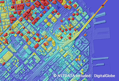
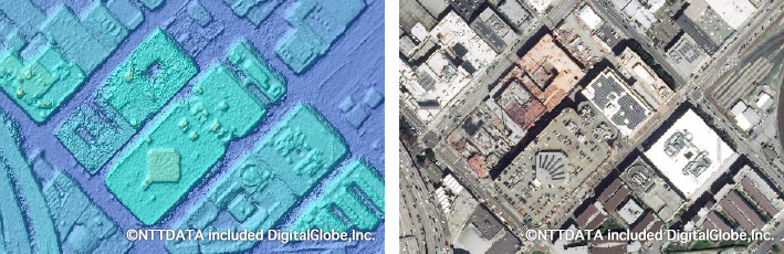
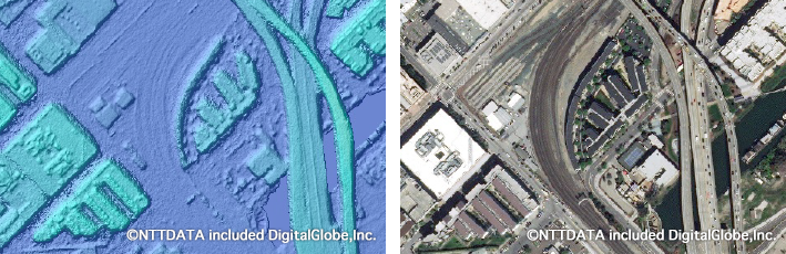
DSM(San Francisco)
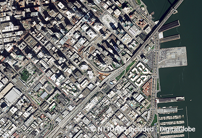
Pan sharpened Imagery(San Francisco)
-
Providing high resolution data from multiple satellites
Since we are generating our DEM data combining multiple high resolution satellite imagery taken with Vantor (former Maxar) satellite constellation, we can efficiently utilize newly taken images as well as our massive collection of archived imagery. This broadens the chance of providing high resolution enhanced data.
-
made-to-order based on your demand
Cherry-picking the source imagery considering the resolution, the date taken, and other factors based on your request. We also generate DEM data not only from archive imagery but also from a new tasking option.
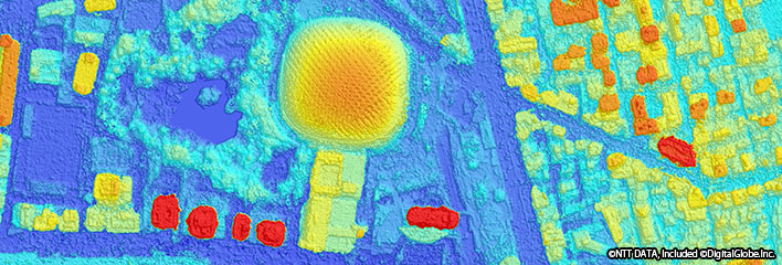
■AW3D Enhanced achieved 30cm accuracy on Accuracy Assessment over San Francisco area
Comparison between DEM and Ortho
Left: 50cm resolution DEM, Right: Ortho
Details
| Product Type | DSM/DTM |
|---|---|
| Resolution | 0.5 m/ 1 m / 2 m |
| Satellite | Vantor (former Maxar Technologies) - WorldView etc |
| Area | On demand |
| Horizontal Accuracy | With GCP: Absolute 1m RMSE / 1.5m CE90 Without GCP: Absolute 2m RMSE / 3m CE90 Relative 1m RMSE / 1.5m CE90 *May vary based on the land characteristic. |
| Vertical Accuracy | With GCP: Absolute 1m RMSE / 1.5m LE90 Without GCP: Absolute 2m RMSE / 3m LE90 Relative 1m RMSE / 1.5m LE90 *May vary based on the land characteristic. |
| Minimum Order Size | 25km2 |
| Delivery Formats | GeoTIFF *Other formats are available on request. |
| Delivery Method | Online or Media (DVD) |
| Optional Services | - Imagery option: resolution 30cm/40cm/50cm - New tasking option - Format conversion service for 3D printer (Conversion to STL file format) |